


Goodness of Fit methods
Goodness of Fit methods
How appropriate is an intervention for a given area?
Some interventions are always a good fit, but others are only a good fit in certain locations. To assess location-specific suitability, we calculate a "goodness of fit" score based on variables such as climate, infrastructure, and household socioeconomic status. To calculate the final score, we collect a range of input variables, convert them into fuzzy space (0-1 scale), and combine them into a single score for each intervention.
Learn more about fuzzy modeling.
Input variables
The following variables were used as inputs to the modeling process:
Fuzzy-converted variables
Input variables were then converted into fuzzy variables by rescaling from their original units to a 0-1 scale. For most input variables, the false (0) and true (1) endpoints of the conversion are set by the 5th and 95th percentile values from the full national dataset of all census tracts:
- Cools off at night on hot days converted from Diurnal temperature difference on hot days.
- Wet bulb depression is high converted from Wet bulb depression during hot hours.
- Heat index is not dangerously high converted from Heat index - percent of summer days under 99°F.
- Days are sunny converted from Daily surface radiation.
- High proportion of renters converted from Percent of households that are rented.
- Housing stock is old converted fromPercent of households built prior to 1980.
- Modest poverty is high converted from Percent of households with income below 200% of federal poverty level.
- AC is low nationally converted from Probability of air conditioning.
- Lots of urban area converted from Percent impervious - non-road urban.
- Lots of roads converted from Percent impervious - roads.
- Many children under 10 converted from Percent of population under age 10.
Some fuzzy variables had slightly different methods of converting from the input variable:
- Many hot WBGT days (converted from Days with WBGT over 27°C for 2 hours) has a true threshold set to 60 to reflect a reasonable duration of hot weather (two months) that may warrant occupational protections.
- High need for cooling (converted from Average cooling degree days) has a true threshold set to 1,200 to include areas where cooling is still necessary, but for shorter durations than in the hottest areas of the country. 1,200 is roughly the mode of US census tracts (= 1,169 CDDs), and equates to a reasonable duration of high heat warranting cooling (60 days at 85°F, or 40 days at 95°F).
- Majority urban (converted from Percent urban) is assigned a value of 0 when the variable Percent urban is <0.5 and value of 1 when Percent urban is ≥0.5.
- Old housing or high rentership is calculated using the fuzzy “OR” arithmetic operation on Housing stock is old and High proportion of renters.
Goodness of fit score
Final goodness of fit scores were determined either by a single variable scaled to a fuzzy equivalent (using national 5th and 95th percentile true/false thresholds) or from multiple fuzzy variables combined using an “or” or “and” operation. “AND” operations are more restrictive, selecting the lowest fuzzy score among the variables, whereas “OR” operations select the highest score among the variables. Some interventions were determined to always be a good fit regardless of location based on expert opinion and/or review of the literature.

Occupational Protections
Worksite Modifications goodness of fit is based on combining Many hot WBGT days and Outdoor workers is high* using the fuzzy “AND” operator.
Cooling Vests goodness of fit is based on combining Many hot WBGT days and Outdoor workers is high* using the fuzzy “AND” operator.
*Outdoor workers is high is a fuzzy variable calculated as a component of the associated heat-health risk score. Original data source: American Community Survey estimate of percent of workforce in outdoor professions, 2015-2019.

Indoor Cooling
Evaporative Cooling goodness of fit is based on combining High need for cooling and Wet bulb depression is high using the fuzzy “AND” operator.
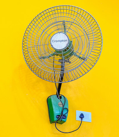
Electric Fans goodness of fit is based on Heat index is not dangerously high.

Utility Supports
Utility Payment Supports goodness of fit is based on Modest poverty is high.

Behavioral Cooling Measures
Foot Immersion goodness of fit is always a good fit regardless of location.
Cold Showers and Baths goodness of fit is always a good fit regardless of location.
Cooling Packs goodness of fit is always a good fit regardless of location.

Heat Early Warning Systems
Public Awareness Campaigns goodness of fit is always a good fit regardless of location.
Heat Action Plans goodness of fit is always a good fit regardless of location.

Cooling Centers
*Extreme poverty is high relative to US is a fuzzy variable calculated as a component of the related heat-health risk score. Original data source: American Community Survey estimate of percent of households below the federal poverty line, 2015-2019.

Cooling Materials and Built Environment Modifications
Reflective or Cool Pavement goodness of fit is based on combining High need for cooling, Days are sunny, and Lots of roads using the fuzzy “AND” operator.
External Shading Devices goodness of fit is based on combining High need for cooling and Days are sunny using the fuzzy “AND” operator.
Outdoor Misting Systems goodness of fit is based on combining High need for cooling and Wet bulb depression is high using the fuzzy “AND” operator.
Splash Parks and Water Play Areas goodness of fit is based on combining High need for cooling and Many children under 10 using the fuzzy “AND” operator.

Hydration and Nutritional Support
Electrolyte Supplementation goodness of fit is always a good fit regardless of location.
Encouraging Hydration goodness of fit is always a good fit regardless of location.

Healthcare Preparedness and Emergency Response
Training Providers on Heat Illness goodness of fit is always a good fit regardless of location.
Mobile Care and Response Teams goodness of fit is always a good fit regardless of location.
Heat-Related Illness Surveillance goodness of fit is always a good fit regardless of location.

Housing and Architectural Design Improvements
Insulation Improvements goodness of fit is based on combining High need for cooling, Old housing or high rentership, and Modest poverty is high using the fuzzy “AND” operator.
Window Glazing goodness of fit is based on combining High need for cooling, Old housing or high rentership, Modest poverty is high, and Days are sunny using the fuzzy “AND” operator.
Building Codes and Standards goodness of fit is always a good fit regardless of location.

Social Connectivity and Community Supports
Targeted Outreach goodness of fit is always a good fit regardless of location.
Community Volunteer Networks goodness of fit is always a good fit regardless of location.

Transportation and Mobility Interventions
Cooled Public Transit goodness of fit is based on combining High need for cooling and Transit distance index using the fuzzy “AND” operator.
Subsidized Transport to Cooling Sites goodness of fit is based on combining High need for cooling, Transit distance index, and the Cooling centers goodness of fit score (above) using the fuzzy “AND” operator.

Policy and Regulatory Measures
Urban Heat Mitigation and Zoning goodness of fit is based on combining the Green Spaces goodness of fit score, Cool roofing goodness of fit score, Cool Pavement goodness of fit score, and Shading Devices goodness of fit score using the fuzzy “OR” operator.
Rental Housing Cooling Infrastructure goodness of fit is based on combining AC is low nationally and High proportion of renters using the fuzzy AND operator.
Data sources
American Forests. Tree Equity Score: Methods & Data. https://www.treeequityscore.org/methodology
NIOSH. (2016). Criteria for a recommended standard: Occupational exposure to heat and hot environments - revised criteria 2016. (2016–106). U.S. Department of Health and Human Services, Public Health Service, Centers for Disease Control and Prevention, National Institute for Occupational Safety and Health. https://doi.org/10.26616/NIOSHPUB2016106
NLDAS project. (2021). NLDAS Primary Forcing Data L4 Hourly 0.125 x 0.125 degree V2.0 (NLDAS_FORA0125_H_2.0) [Dataset]. Goddard Earth Sciences Data and Information Services Center (GES DISC). https://doi.org/10.5067/THUF4J1RLSYG
NOAA-NCEI. Cooling degree days by county [Dataset]. https://www.ncei.noaa.gov/access/monitoring/climate-at-a-glance/divisional/mapping
Romitti, Y., Sue Wing, I., Spangler, K. R., & Wellenius, G. A. (2022). Inequality in the availability of residential air conditioning across 115 US metropolitan areas. PNAS Nexus, 1(4), pgac210. https://doi.org/10.1093/pnasnexus/pgac210
United States Census Bureau. (2023a). American Community Survey (ACS) [Dataset]. https://www.census.gov/programs-surveys/acs
United States Census Bureau. (2023b). Urban and rural [Dataset]. https://www.census.gov/programs-surveys/geography/guidance/geo-areas/urban-rural.html
US EPA(a). Distance to nearest transit stop, Smart Location Database [Dataset]. https://www.epa.gov/smartgrowth/smart-location-mapping#SLD
US EPA(b). Level I Ecoregions [Dataset]. https://www.epa.gov/eco-research/ecoregions-north-america
US EPA. (2016). Excessive Heat Events Guidebook (EPA 430-B-16-001). https://www.epa.gov/sites/default/files/2016-03/documents/eheguide_final.pdf
U.S. Geological Survey (USGS). (2024). Annual NLCD Collection 1 Science Products (Impervious Descriptor) [Dataset]. https://doi.org/10.5066/P94UXNTS
USDA Forest Service. NLCD Tree Canopy Cover [Dataset]. https://www.mrlc.gov/data/type/nlcd-tree-canopy-cover